
Contents
|
Section Y click on thumbnail to see larger photo. Back |
||||||||||||||||||||||||||||||||||
http://www.cheyenneretreat.com/ email
escape@cheyenneretreat.com |
||||||||||||||||||||||||||||||||||
 |
 |
 |
||||||||||||||||||||||||||||||||
|
An early start, as it is best to get the long climb over before it starts to heat up. Can be a real problem with dehydrtaion if you try to climb out on a hot summer afternoon. |
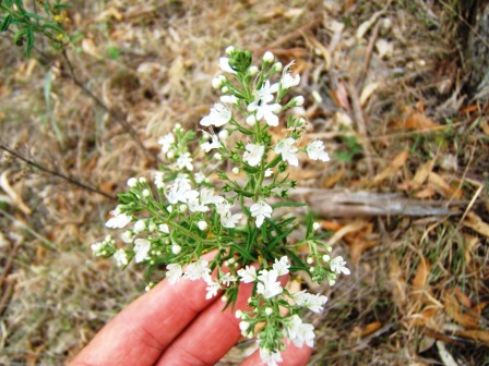
Teucrium corymbosum is an attractive plant about 1.5 m high, with densely glandular branches, opposite 2-11 X 0.6- 2 cm toothed leaves, and clusters of white flowers with an obvious lip. Growing here in very dry skeletal soil. |
A bit before 7 am on a November morning, and Blue Mountain Creek is still filled with mist. (Photo Martin Lang) |
||||||||||||||||||||||||||||||||
 |
%20939%20951.jpg) |
 |
||||||||||||||||||||||||||||||||
|
This ridge is reputed to be one of the main access routes for the Aboriginal people moving from their winters on the coastal plain to summer on the Tablelands. You are walking in the footsteps of the ancients. (But they were probably fitter than us!). |
Acacia ingramii is a rare wattle with nearly all its population protected in Oxley Wild Rivers National Park. The phyllodes narrow-linear, 7-14 x 0.2-0.4 cm, with an acute point. The flowers are clustered in 5 mm globular heads in late winter-Spring, and are followed by irregularly twisted 4-7 x 0.5-0.7 cm pods visible in the photo. |
Almost straight down into an area kept clear by the wild horses you sometimes see from here.
|
||||||||||||||||||||||||||||||||
 |
 |
 |
||||||||||||||||||||||||||||||||
|
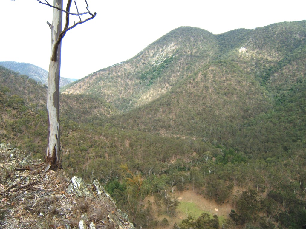
The horse clearing from the previous photo. The unnamed skyline spur meets Blue Mountain Creek about 41.5 km above Hole Creek camp. |
The dark green of the dry rainforest is distinctly visible in the streamlines. There’s about 190 species that are found almost entirely in these narrow scattered communities- and they are one of the main reasons Oxley Wild River is a World heritage area. |
Native Sarsparilla (Indigofera australis) is a pea plant that hosts nitrogen-fixing bacteria in its root nodules, which is pretty handy in such nutrient-poor soils. |
||||||||||||||||||||||||||||||||
 |
 |
 |
||||||||||||||||||||||||||||||||
|
We have been climbing for an hour and a quarter, and we’re about halfway to the cleared country on top. You use time rather than kilometres to measure journeys in this kind of country. |
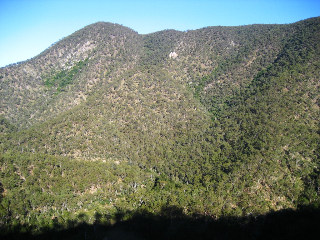
The cleared country opposite is the Enmore area, about level with the property ‘Hazeldene’. |
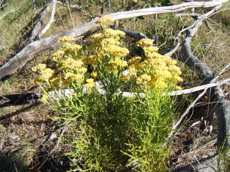
Ozothamnus adnatus is a very attractive small shrub. The leaves are ‘adnate’- (fused to the stem for c. 1/2 length) linear, 2-7 X <1 mm wide. Dense twiggy habit would make it a good rockery subject. Maybe wouldn’t survive in gentle garden conditions. |
||||||||||||||||||||||||||||||||
 |
 |
 |
||||||||||||||||||||||||||||||||
|
Soft Leaf Pea Pultenea foliolosa is a ground-covering pea with elliptical, concave, 1-4 (rarely 6 mm)X 0.5-2 mm leaves with rolled margins. Forms dense thickets occasionally on the centre of ridges. |
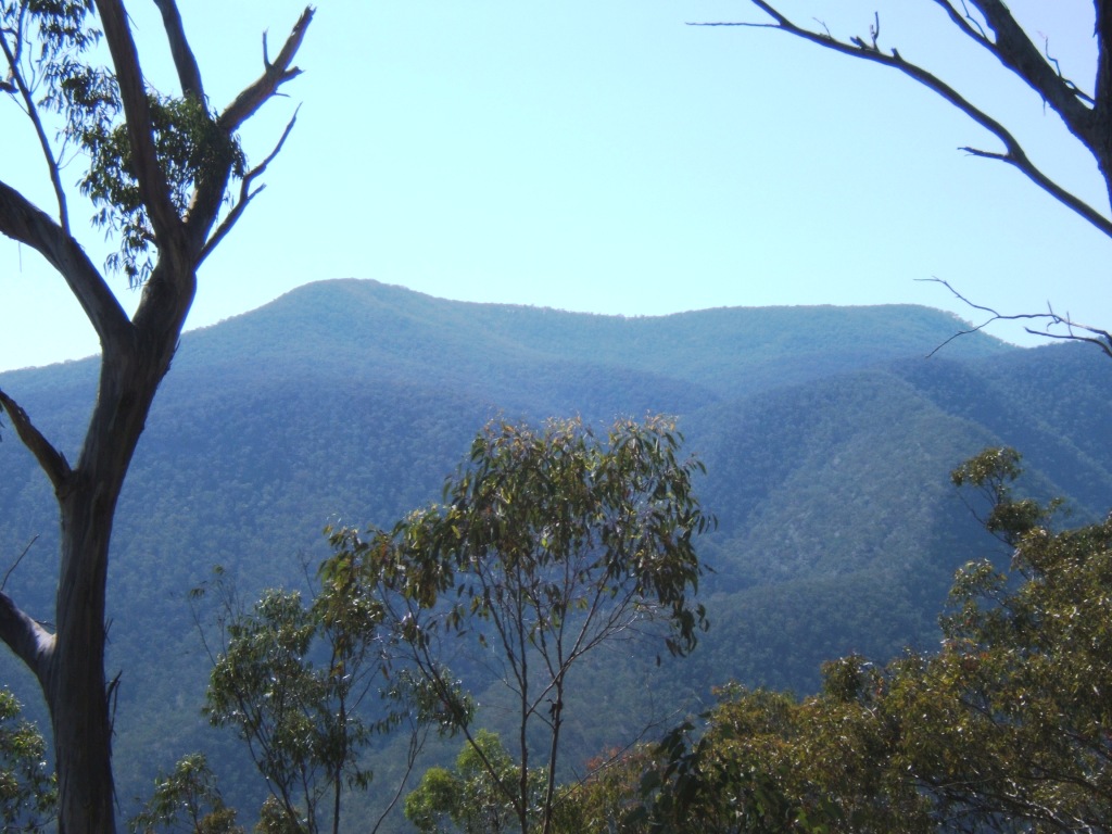
Getting well up now- only about another half-hour to the dingo fence gate. The distinctive flat profile of Enmore Long Point forms the skyline here. |
Hole Creek runs across our near front, and the narrow spur leading up to the right side of the photo is the route followed in Section X- a surprisingly straightforward walk from BMC- Hole Creek camp up to Tabletop Trail. |
||||||||||||||||||||||||||||||||
 |
 |
 |
||||||||||||||||||||||||||||||||
|
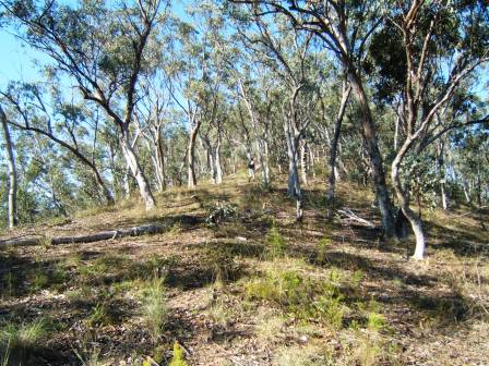
The open country, and a bit of flat walking for a while! Betweeen 2 and 21/2 hours is good going from Blue Mountain Creek to here. Now comes the really good views. |
This part of the tops has good soil and gets fairly consistent rain- I’ve never seen it anything but bright green. |
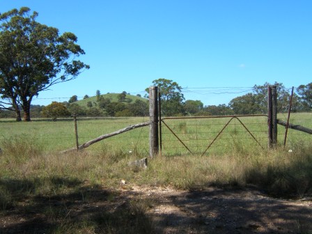
A few minutes past the Dingo Fence. |
||||||||||||||||||||||||||||||||
 |
 |
 |
||||||||||||||||||||||||||||||||
|
Don’t worry- it’s worth this last bit of a climb.
|
Don’t forget to look back down Blue Mountain Creek. |
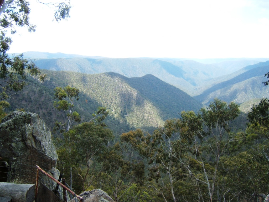
Looking almost due North across Blue Mountain Creek directly towards Blue Nobby Mountain, the symmetrical bump on the far skyline. |
||||||||||||||||||||||||||||||||
 |
 |
 |
||||||||||||||||||||||||||||||||
|
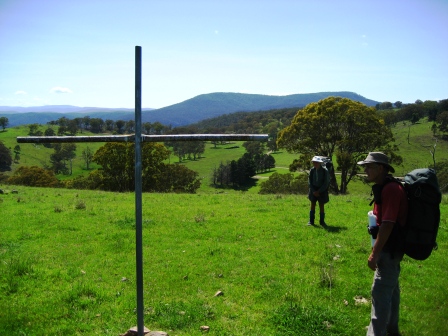
A good place for a few moments of quiet reflection. |
Reading the plaque |
|
||||||||||||||||||||||||||||||||
 |
on the left ~ Burg and Sue’s little terrier greets all incoming visitors. |
 |
||||||||||||||||||||||||||||||||
|
||||||||||||||||||||||||||||||||||
|
|
||||||||||||||||||||||||||||||||||
