
Contents
|
Section N click on thumbnail to see larger photo. Back |
|||||||||||||||||||||||||||||||||||||||||||||||
|
Section N Photoguide
An easy walk down to Tabletop Trail, the 4WD that runs around the mountain. For many people, going UP this route FROM Tabletop Trail is the easiest (and safest) way in to the Cocks Comb. This was the way people on horseback (and, later, on trailbikes) came, and continued on down Kerosene Spur to the Macleay. Whichever way, you will probably get water at Zinnia dam. |
|||||||||||||||||||||||||||||||||||||||||||||||
 |
 |
||||||||||||||||||||||||||||||||||||||||||||||
|
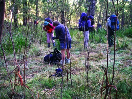
The bustle of packing up after camping in Cocks Comb Saddle. There were ten in the party, and as we had brought plenty of water, it was a comfortable camp. It is quite cool in summer, and in winter surprisingly warm due to the drainage of cold air away down the mountain. (Photo Don Hitchcock) |
There is a bit of contouring back and forth as your edge your way down from the saddle through eucalypt woodland with an understorey of thin, closely-spaced shrubs. It is a good idea to aim for waypoint MACLCCOMB8 AG66 0397056.6590859, so you do not edge too far around the mountain. |
||||||||||||||||||||||||||||||||||||||||||||||
 |
 |
||||||||||||||||||||||||||||||||||||||||||||||
|
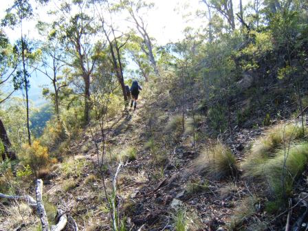
This is near MACLCCOMB8 AG66 0397056.6590859, the start of the horsetrack that leads down to the Macleay via a long spur to the S of Kerosene Creek. You cross it at right angles when going down to CCOMBSPN1AG66 97326.92766- where you meet the 4WD Tabletop Trail. Alternatively, just aim 150 m W of CCOMBBABY, the cone-shaped little hill on your right as you head downhill. |
If water isn’t needed, just continue down the ridge to CCOMBSPN1 AG6697326.92766. If it is, leave the track at about AG66 974.921 and walk 125 m NW across Zinnia Creek to Waypoint ZINNIADAM at AG66 97357.92184. The water will need tablets or boiling before use. Then it is best to walk about 125 m NNW to meet Tabletop Trail 4WD road at AG66 97250.92250, and walk along it 500 m, crossing Zinnia Creek, to CCOMBSPN1. (Photo Don Hitchcock) |
||||||||||||||||||||||||||||||||||||||||||||||
