
Contents
|
Macleay to Blue Nobby click on thumbnail to see larger |
||
 |
 |
 |
|
The ridge starts at MACL965020 , 300 metre above sea level, and just above a little gully about 30 km below Mihi Junction. It’s a good idea to put all these waypoints in at home, so you can check them against each other in comfort- not while freezing in the rain with zero visibility. |
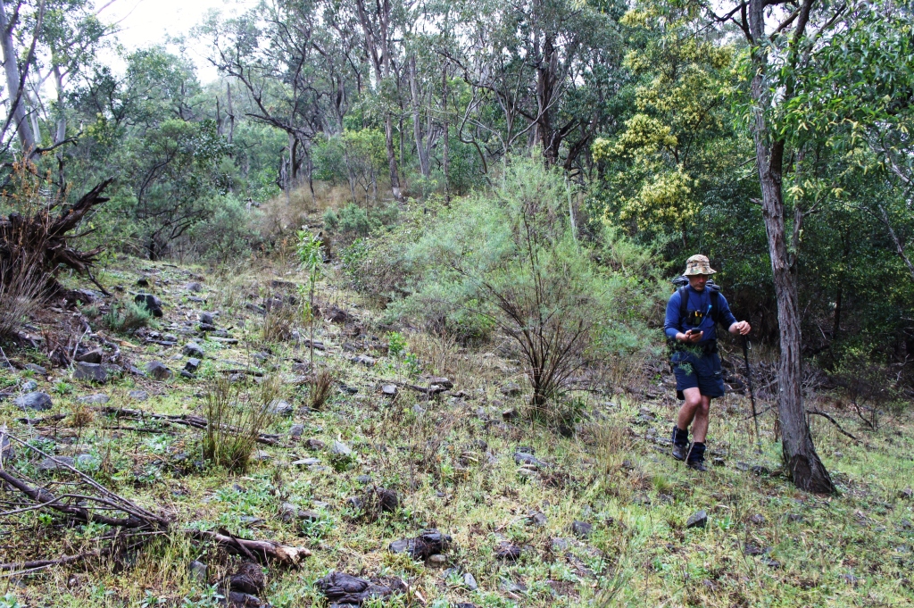
Just 10 minutes into the climb, at 963.019, and already getting good views down into the Macleay.
|
Twenty minutes up, at 961.018, and on an evenly-sloping narrow ridge.
|
 |
 |
|
|
Variable Groundsel ( Senecio pinnatifolius var. pinnatifolius) at 961.017. You often see this pretty daisy on these steep rocky ridges.
|
The ridge is narrowing further at 957.015, and we are hoping for the mist to lift to see the views. |
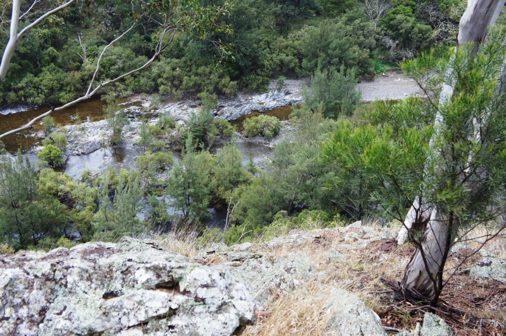
View NNW up Macleay from 956.015. Still very misty- Mill Creek is just around the sharp bend at the top right. |
 |
 |
 |
|
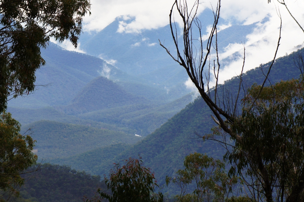
An hour from the start of the climb, looking west along the cliff line from 955.014, at an altitude about 580 metres. We’ve climbed about 280 metres so far. |
Sticky Cockspur Flower (Plectranthus graveolens) at 951.012. These plants share the strong scent of other members of the Mint family . They are almost always found among rocks on steep ridges. |
The spur has broadened out, and we are passing a stand of Forest Oak ( Allocasuarina torulosa- tree with thin thready foliage and round 3 cm cones)- signs that we are nearing the top of the ridge. |
 |
 |
 |
|
View due N to the base of the Heart from 948.008. The mist makes it hard to distinguish features, but the cone-like hill in the left centre just hides the open area around the stockyards below HEARTNOB1 . Altitude 890 metres- nearly 600 metres climbed. |
A Red-Bellied Black Snake (Pseudechis porphyriacus ?)at 936.008. These are generally found on riverbanks- this one was not far from a swampy area. There are no recorded human deaths from their bite. |
With all the serious climbing done -we’re at 92762.00688, altitude 1100- a long log lunch is called for amongst the Snow Grass, Blue Gums and Diehard Stringybark. |
 |
 |
 |
|
This logging road curls around the hill at 926.008- some very welcome easy walking . |
The road continues - this view looking back at 920.088. |
The end of the old Enmore State Forest at 914.011. The sign bans the collecting of firewood, as it is now part of Oxley Wild Rivers National Park. You can spend a fair bit of time wandering around the old logging roads that extend through this area. |
 |
 |
 |
|
Dingo Fence Gate at 91383.01078 ENMSFDGATE , view NNW. A dramatic contrast between the regenerating forest and the cleared- and recently fertilized- ‘Blue Nobby’ property. At the moment, an ill-defined right-of-way exists through the property, but you would need to check exactly where it goes to avoid trespassing. It is NOT necessarily on the property road.
|
This is the view looking from Blue Nobby Mountain trig at 160 degrees- the arrow marks where you emerge from Enmore State Forest, through the Dingo Fence gate. |
View West to Blue Nobby yards from 909.009. This photo was taken in September 2011, in the best season in living memory. You’ll probably never see it look better. |
|
|
||
|
Car in sight from 905.008, at the old woolshed on ‘Blue Nobby’ BN WOOLS It took about 5 hours walking- NOT including lunch or tea breaks- from the Macleay to the car. Would take another 40 minutes to climb back to Blue Nobby Summit. |
||
